North America   /   History

Panama Canal

A working waterway that changes the geography of global trade.

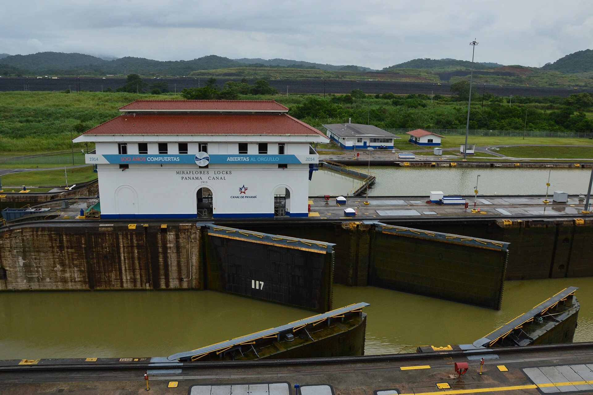
The Miraflores locks on the Panama CanalWonder94
The Miraflores locks on the Panama CanalPhoto: Ivo Kruusamägi, CC BY-SA 4.0

Summary

The Panama Canal is a working waterway across Panama, connecting the Atlantic and Pacific. Channels, artificial lakes and locks raise and lower ships to carry them through the interior of the isthmus.

The canal makes global trade visible through a carefully orchestrated encounter between ships, water and engineering. Watching a lock operation gives abstract geography an immediate physical meaning.

1–100 · The Original 100

The essentials

Explore the full photo gallery →

Allow time

Half a day to 2 days, depending on the experience

Choose a base

Panama City

Getting there

Fly to Panama City, then take an authorised taxi, transfer or tour to the Miraflores visitor area. Agua Clara on the Atlantic side is a separate excursion. Boat transits depart through operators with their own schedules.

Plan ahead

Check the official visitor centre's current ship-viewing guidance before choosing a time. Confirm which locks a tour visits and whether it includes an actual transit or only shore observation. Bring sun and rain protection.

Guide edited 29 September 2026. About practical information

A closer look

Why it stays with you

Opened in 1914 after a difficult and costly history of construction, the canal has continued to evolve, including the later expanded lock system. It is also a human story involving labour, disease, sovereignty and international trade. Visitor interpretation is most valuable when it explains those dimensions alongside the machinery.

A lock-side viewpoint shows the scale and precision of a transit, but timing matters: ships do not appear simply because visitors arrive. A partial transit or a journey towards the wider watershed offers another perspective. Fresh water is essential to the system, linking canal operations to the surrounding environment and rainfall.

Background reading: Miraflores (Panama) · Panama Canal.

The scope of this entry

What’s included.

  • A ship moving through a lock chamber
  • Visitor interpretation of the canal's history
  • A wider view of the canal watershed or a booked partial transit

Make this the moment

The essential experience.

Time a visitor-centre visit around confirmed ship activity or book a suitable partial transit.

Alex’s journey · VisitedFollow the journey →

Understand the wonder

The canal is a landscape-scale machine.

The Panama Canal connects engineering with geography, water management and global trade. Watching a ship pass through a lock reveals only one part of a much larger system of lakes, channels and infrastructure. Understanding how vessels are raised and lowered makes the movement meaningful rather than merely slow. The canal also has a complex political and labour history. A visitor centre and a broader transit experience provide different kinds of insight.

Continue the background reading in the reference links below.

The Miraflores locks on the Panama Canal
A lock chamber at MirafloresPhoto: Ivo Kruusamägi · CC BY-SA 4.0

Slow down. Notice more.

Look for this.

LOOK 1

The changing water level within a lock.

LOOK 2

The clearance around a large vessel.

LOOK 3

The relationship between locks and the lake system.

Beyond the familiar view

Watch an operating system.

The Panama Canal is impressive because it is working infrastructure. A vessel's movement through the locks gives meaning to the scale of the structures and the management of water. Interpretation helps connect the visible operation with the wider crossing between oceans.

The choice that changes the visit

Check the visitor centre's current opening arrangements and information about ship movements. Allow enough time for an operation to unfold rather than treating the stop as a quick photograph.

Follow the background and visitor sources →
The canal and locks from the visitor centre
The canal and locks from the visitor centrePhoto: Adam Jones · CC BY-SA 2.0

From inspiration to itinerary

Plan your visit

Sources & useful visitor links

Before you set off.

Your ticks stay in this browser. Use the official visitor and reference links below →.

Through the seasons

Get your bearings

A place in the world.

Panama

A place in the world
Panama Canal location mapPanama Canal location map

Select the pin to open a detailed map. Use Closer look to see the surrounding region. Drag to move a zoomed map.

Map: Natural Earth

Panama Canal. 9.12° N, 79.75° W. Location reference.

Open a detailed map ↗

A closer view

The places within the place.

Selected sights and gateways to help you understand the area.

3 selected places

Load the street map to zoom and explore. Map imagery is supplied by OpenStreetMap.

  1. 1
  2. 2
  3. 3

A wide spread of points usually means separate outings or bases. Use current local guidance for the route between them. Report a map issue ↗

Go a little deeper

Further reading.

For tickets, permitted routes and changing access, use the official links in Plan Your Visit. Explore the wider reading list →

Make room for the journey

Combine it with…

A Costa Rican wildlife stay can extend a Panama visit into a broader Central American journey. Allow proper international transfer time and choose a small number of forest bases rather than trying to cover both countries quickly.